Introduction
Nowadays, flying drones or UAVs have achieved many profits, such as becoming safer and smarter because of advanced technology, which couldn’t be possible without adding various sensors to the drones. One of these sensors is the radar altimeter.
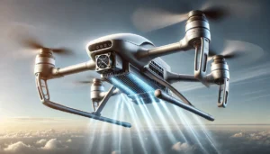
A radar altimeter for UAV is sensor that enables them to measure their altitude, which is a measure of how high they are above the ground. Altimeters use radio waves to measure the altitude, and helps them to fly safely over different surfaces by giving them the information required to avoid crashing into the surface.
Table of Contents
How Does a Radar Altimeter Work in UAVs?
Generally, drones use different sensors to estimate their altitude. Whether it is a barometer sensor, that can give the altitude based on the atmospheric pressure, or a GPS that can provide the altitude information in addition to latitude and longitude information.
And of course they can use a radar altimeter. There are other technologies such as LiDAR or laser altimeters, or vision-based technologies. Each one them has its pros and cons.
Radar altimeters send out a radio wave signal down to the ground and measures the time it takes for the signal to return, and by knowing the propagation speed of the wave, the UAV can figure out the distance to the ground.
Key Benefits of Using Radar Altimeters for UAV Flight Stability
When it comes to radar altimeters for UAVs, we can mention some benefits that are practical for making drone flights safer and more stable compared to other technologies such as LiDAR or laser altimeters and vision-based technologies.
- The first one is being able to give accurate and updated altitude information to the pilots even in tough conditions, including fog and dust. For example, the update rate of a GPS can be very low (around 5Hz) while the radar altimeters can have an update rate in the range of 100Hz or even more.
- The second one is being more reliable because they are less effected by other sensors and weather. For example a barometer should be installed very carefully inside the drone such that the wind does not affect its readings.
- The last one is about helping drones stay at a safe height above the ground in order to reduce crash risks. In some applications like agriculture, it is important to maintain a specific distance to the crops for spreading the seeds and spraying them, which can be achieved using a precise altimeter.
In conclusion, radar altimeters for UAVs help pilots in many ways, improve safety during the flights, work well in all weather, and last but not least, make flights more efficient.
Choosing the Right Radar Altimeter for Your UAV
When you want to choose a radar altimeter for your UAV, you need to consider some factors to find the right radar altimeter. Here you can keep some of them in mind:
- First, you must think about how high or low you want your UAV to fly because different radar altimeters can measure different heights, so pick one that fits your needs.
- For some applications, such as mapping or surveying, you need to keep the drone as close as possible to the true height, so the second important factor can be checking the accuracy ratings of the altimeter.
- Make sure the altimeter is light and small so it can fit on your drone without bearing extra weight on the drone during which can reduce its flight time.
- Look for radar altimeters for UAVs that have a common format so it is easier to connect with your drone.
- Consider all the parts of your drone, like the GPS, camera, and flight controller, while choosing radar, and make sure they all work well together.
- Check your budget against the features of different radar altimeters for UAVs.
- Finally, think about the usage of your drone when you need it for farming or searching; it may need some special features as well.
Integration of Radar Altimeters with UAV Autopilot Systems
The integration of the altimeter to your drone heavily depends on the autopilot system that you are using, as well the interfaces of each. You should check the interface of your sensor, whether it works with I2C, UART, CAN, or other technologies.
In addition to that, each manufacturer may integrate its own packet protocol for communication with the sensor, which should be implemented in the autopilot. However, some autopilot systems such as Pixhawk, which is an open-source autopilot system, tries to support most of the well known sensors to make it easier for the end user to integrate the altimeter into its system.
The data from the altimeter replaces the data from other sensors or can be fused with them to make the system more robust in altitude estimation. The estimated altitude is then used within the autopilot’s control loop to perform the desired mission.
Consequently, the drone has information about how high it is flying above the ground, and meanwhile, they help the drones to overcome some obstacles, such as flying low or going over a hill, so together they prevent crashes, fly better and longer, adapt to different environments, and do a variety of tasks.
Top Radar Altimeter Models for UAVs in 2024
1. Flightcase Radar 24GHz Miniature UAV Drone Altimeter, ISTRA24
The Flightcase radar (ISTRA24 radar) is a compact and lightweight radar sensor designed for easy mounting on drones or other vehicles. This millimeter-wave altimeter can accurately measure altitude within a range of 0.2m to 50m, making it ideal for applications like hovering or terrain-following at a specific height above ground level. It is compatible with popular open-source Ground Control Station (GCS) software, including MissionPlanner and QGroundControl.
Operating in the 24GHz frequency band, the ISTRA24 radar transmits at 20dBm power and utilizes Frequency Modulated Continuous Wave (FMCW) technology for distance measurement. With a refresh rate of 50Hz, it connects to drones via a UART interface (TTL voltage level).
2. LR-D1 Pro Radar Altimeter
The LR-D1 Pro is a dual-band long-range radar altimeter, designed for enhanced performance. It features a 60 GHz antenna for centimeter-level precision at low altitudes and a 24 GHz antenna for improved accuracy at higher altitudes. The LR-D1 altimeter delivers reliable performance in all environments and weather conditions, even in the harshest and most challenging low-visibility scenarios. The LR-D1 Pro is especially suited for larger UAVs (85kg+), VTOL aircraft, helicopters, and mission-critical tactical operations where heightened precision and rugged durability are essential.
3. US-D1 Radar Altimeter
The US-D1 radar altimeter is a compact sensor designed to deliver accurate altitude measurements up to 50 meters, making it an excellent choice for UAV and drone applications. It features a small form factor for easy integration. It is simple to use, plug & play ready, and doesn’t need to be calibrated. Ardupilot and PX4 firmware are supported.


